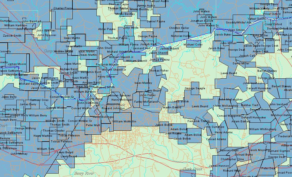
This page provides a pictorial view of the original land grants of Burke and Lincoln Counties. This land became Catawba County after the formation in 1842.
I am deeply indebted to Dr. J. C. Smith, Emeritus Assoc Professor, Civil Engineering Dept.,
N. C. State University for his generous donation of this research material to the public domain.
NW portion of Lincoln/Burke County Land Grants
From the the area around Drexel, Burke County and the land holdings of William Harbinson at the NW portion of the map to the Oxford area, north of the Catawba River, in Alexander County, the upper boundaries of thias map are formed. from the SE part of the map, Conrad Pooveys land, currently west of the town of Catawba, near Catfish, westward to the an area currently known as Henry river, and the land of the Settlemyre's, forms the SW boundary of this map.
The map can be enlarged by using the "enlarge"
icon.
For more detailed information on Land Transactions, please see this site <CLICK>
These pages are copyrighted in the name of the NCGenWeb Project and/or the submitters and webmaster of this project.
They may not be used, housed or copied by any for-profit enterprise. Fair Use Doctrine allows for exerpting limited portions.

Derick S. Hartshorn - ©2008
Last Modified: