Skip to content

Pender County, NCGenWeb

  • Home
  • About the County
  • Records/Data
  • Queries & Lists
  • Research Aids
  • Surnames
  • Contact

Category: Maps

1738 Wimble Map

Contributed by Barbara Shore

Author taneya@gmail.comPosted on April 8, 2012Categories MapsLeave a comment on 1738 Wimble Map

1733 Mosley Map

Contributed by Barbara Shore

Author taneya@gmail.comPosted on April 8, 2012Categories MapsLeave a comment on 1733 Mosley Map

1930 Pender County Map

Author taneya@gmail.comPosted on April 7, 2012Categories MapsLeave a comment on 1930 Pender County Map

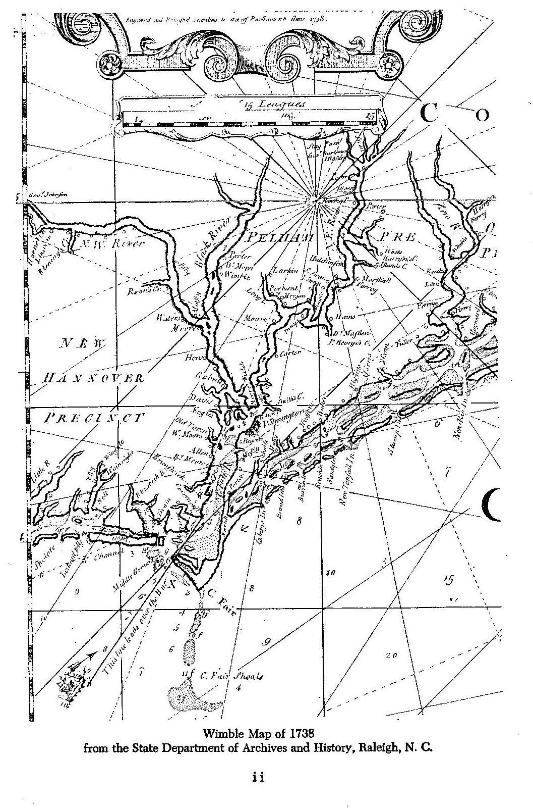
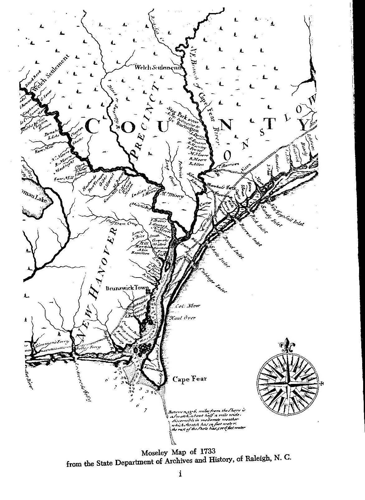
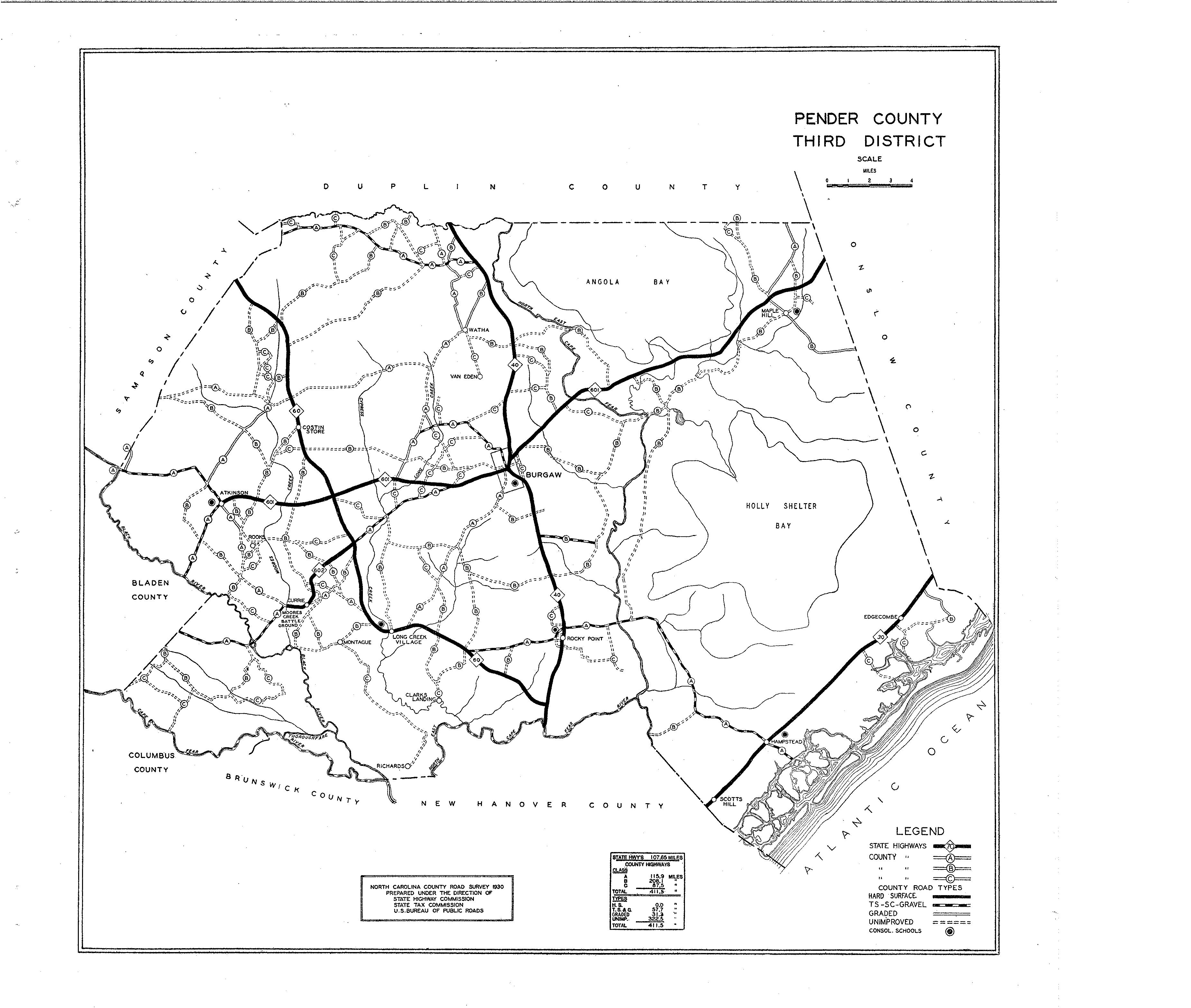
Pender County Civil War Map

This map below of New Hanover County area that shows where Pender came from.
Contributed by Bill Vanlandingham.


Author taneya@gmail.comPosted on March 11, 2012Categories Maps

Join NCGenWeb on Facebook

facebook logo

Adopt Me!

adopt

Questions? Comments?

Contact Susan C. Griffin, the NCGenWeb Coastal Regional Coordinator.

Affiliations

Copyright

© NCGenWeb & all content contributors. All rights reserved.

Site Last Updated

June 15, 2019

  • Home
  • About the County
  • Records/Data
  • Queries & Lists
  • Research Aids
  • Surnames
  • Contact
Pender County, NCGenWeb Proudly powered by WordPress