
Return to Pamlico Co. Homepage
Return
to Pamlico Co. Homepage
![]()
A New and Correct Map
of the Province
of North Carolina (1733) By Edward Moseley
 |
 |
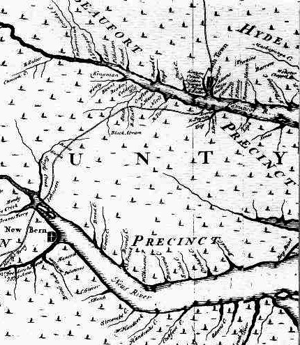
Crop of Moseley's 1733
map depicts the area of Eastern North Carolina along
the Pamticoe (Pamlico) River showing the names of many of the early settlers.
![]()
A New and Correct Map of the Province of North Carolina (1733)
By Edward Moseley
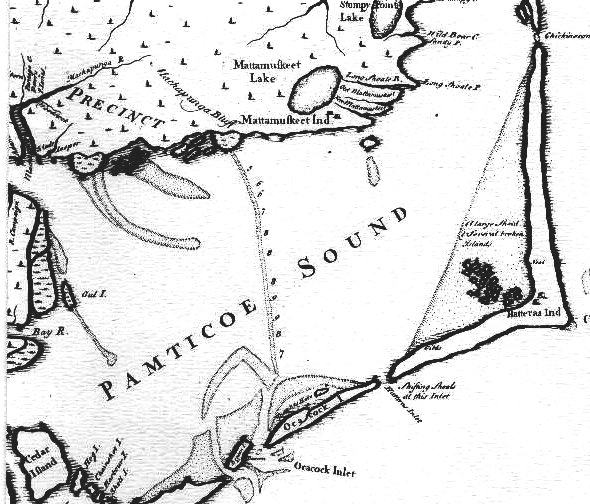
Edward Moseley's map not only shows a great increase in geographical knowledge of the whole coastal area of North Carolina but also shows significant developments in the pattern of settlement of the rapidly increasing population. His map included details of land formation, of rivers, creeks, and waterways back of the sounds. There is a wealth of names of the chief settlers and larger plantations of Albemarle Sound and the rivers flowing into it, on Pamlico River, on Neuse River and its tributaries, oand on the Cape Fear River. These names reflect the accelerated influx of settlers into North Carolina in the two decades preceding the appearance of Moseley's map, and the location of settlers on rivers shows the importance of water transportation as the chief means of communication. It was the chief and often the only means of travel and moving of products, for roads were few and poor.
![]()
Copy of Moseley Map
The Friends of Joyner Library have made available for purchase, 26" x 33", reproductions of the Moseley Map, on high quality parchment cover stock, suitable for framing. Included with the purchase of the map is an extensive and detailed source of information on the names and locations of early settlers, plantations, and Indian tribes along the 1733 North Carolina coast. For information on purchasing the Moseley Map, see: Friends of Joyner Library, or questions can be directed to Douglas Smith or for questions call (252) 328-4090.
![]()
Source: The Southeast In Early Maps, by William P. Cumming; 1962. Chapel Hill, NC: UNC Press.
![]()
|
|
|
© 2007 McGowan/Sheppard