Return to Hyde County
![]()
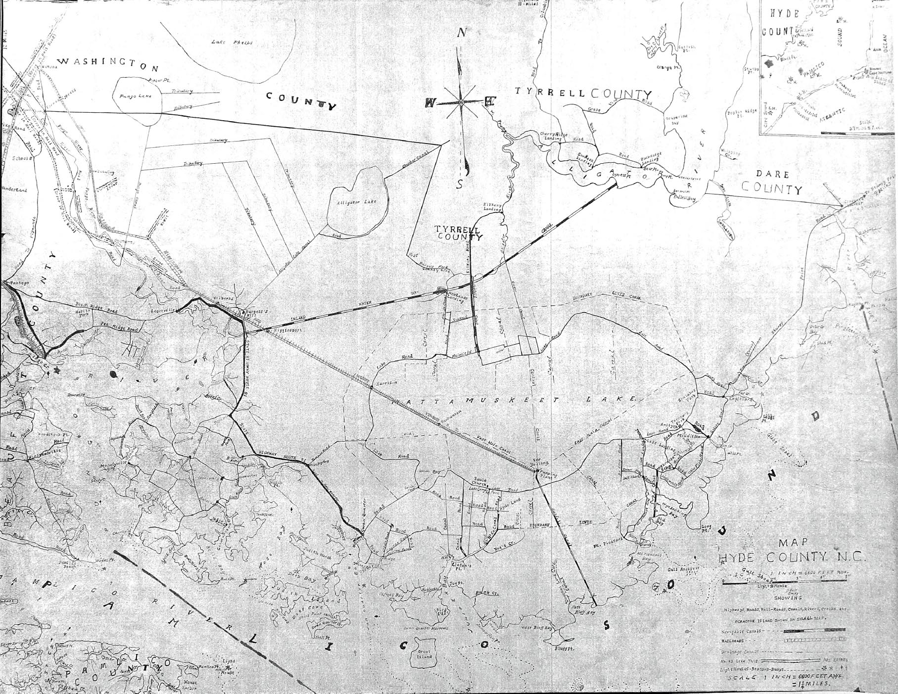
Hyde County, NC Map - circa 1920
Drawn by George Munsey
Weston
Contributed by Merlin S.
Berry
Graphic by Betsy
Olkowski
![]()
From records that could be found, George Munsey Weston (1888-1938) drew this map between 1917 and the early 1920s. It measured 3' wide x 2'4" tall. George's 1917 WWII Draft Card indicated that he was an independent land surveyor for Hyde County. George never married and was buried in Soule Cemetery next to his parents. You can view a family photo here. A copy of the map was sent to me in 2014 by Merlin S. Berry who said the story was that...."Muncie was known as "odd." His intelligence was of a different kind. He may have been what today is called "autistic." He had artistic ability, obviously. He was known for riding his bicycle with his axe for chopping wood and things for people in a tow sack, because he did not want the wind to blunt the axe blade. Apparently he rode his bicycle all over Hyde to do his map right.” The Mattamuskeet Foundation says the railroad began service in 1921, but he might have drawn the railroad line based on earlier plans.
Betsy Olkowski took a digital photo of the map and reduced the size enough that it could be used on the Hyde website, however, it's still quite large and you will have to move the page from side to side to view parts of the map and you may have to use a magnifying glass to see the smaller print. OR use Betsy's tip of making the image larger by left clicking inside the map. Then while holding down the "Ctrl" key with your left hand, with your right hand, use the scroll wheel on the mouse and scroll up to increase the size or scroll down to decrease the size. Scrolling up will increase the size of the map and those areas that are so small will become much larger and much more readable. Merlin provided a PDF color version of Munsey Weston's map and you can view it and enlarge it here but it is a very large file, however, you can enlarge it to see the small details and wording.
 |
![]()
|
|
© 2016 Kay Midgett Sheppard