Return to Dare County
![]()
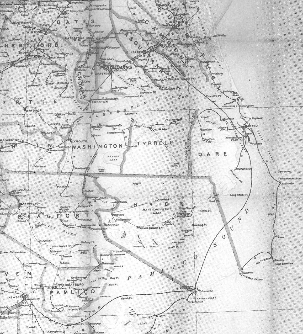
Postal Route Map - 1896
![]()
Rural free delivery of mail by the United States Post Office Department began in 1896, and after that year the small fourth class post offices to which mail had been delivered began to disappear. The official Post Route maps of 1896 show every post office then open, the roads or paths by which the mail traveled between them, and the distances between the post offices on the routes. The routes were subject to change or expansion which were recorded on these official maps; no other maps of the period give more detail concerning hamlets and other centers of population with the connecting roads then in existence. This Post Office map of 1896 records the topography of the area before the changes which came after the introduction of the automobile.
 |
![]()