Return to Dare County
![]()
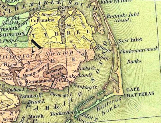
Henry Schenk Tanner Atlas - 1834
(Permission for use from the University of
Connecticut, Homer Babbidge Library)
![]()
Henry S. Tanner was one of America’s foremost engravers and map makers in the first half of the 19th century. By the time he began producing his own maps he had engraved many notable maps for cartographers Aaron Arrowsmith, Samuel Lewis and John Melish. In his Geographical Memoir, Tanner claimed he had devoted nearly ten years of his life to his monumental map of North America.
|
|
© 2007 Kay Midgett Sheppard & Marla Beasley