Return to Dare County
![]()
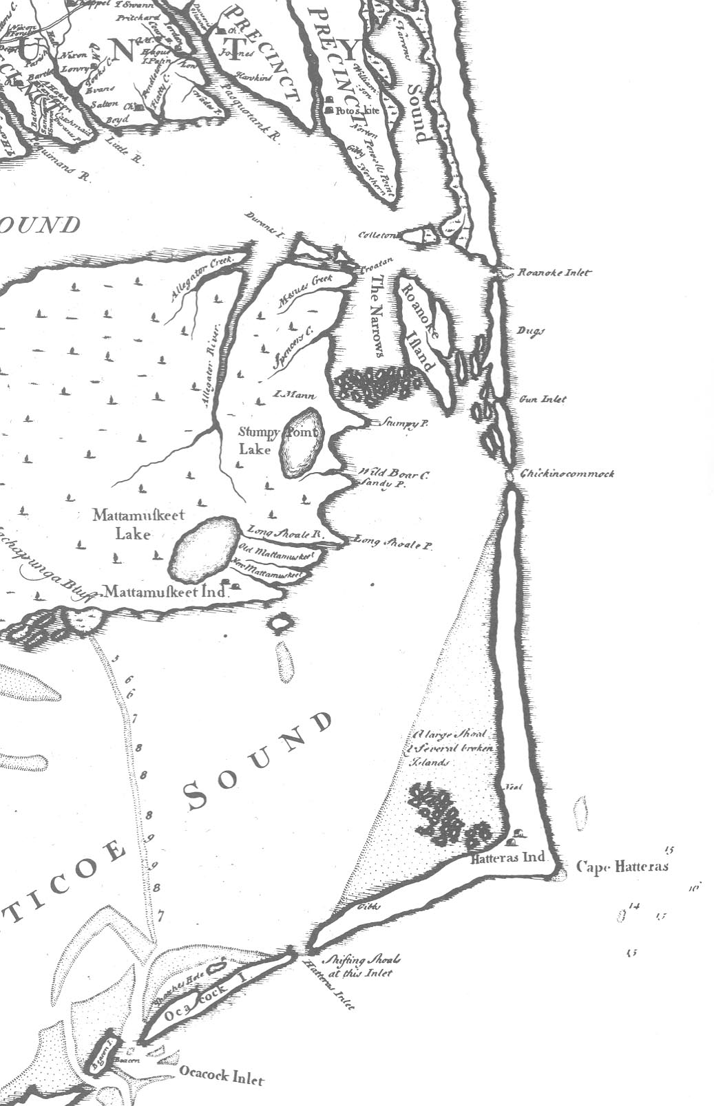
Edward Moseley Map - 1733
![]()
Edward Moseley's map of North Carolina not only shows a great increase in geographical knowledge of the whole coastal area but also shows significant developments in the pattern of settlement of the rapidly increasing population. For over fifty years European man makers had copied the maps of Ogilby and Gascoyne with little or no change for the North Carolina region, which was usually included only with maps of South Carolina or of a larger area. This is, indeed, the second map printed of North Carolina alone. The first is the White-deBry map, nearly a hundred and fifty years earlier. The details of land formation, of rivers, creeks and waterways back of the sounds are numerous. There is a wealth of names of the chief settlers and larger plantations of Albemarle Sound and the rivers flowing into it. These names reflect the accelerating influx of settlers into North Carolina in the two decades preceding the appearance of Moseley's map, and the location of settlers on rivers shows the importance of water transportation as the chief means of communication.
 |
![]()