
Return to Currituck Co.
![]()
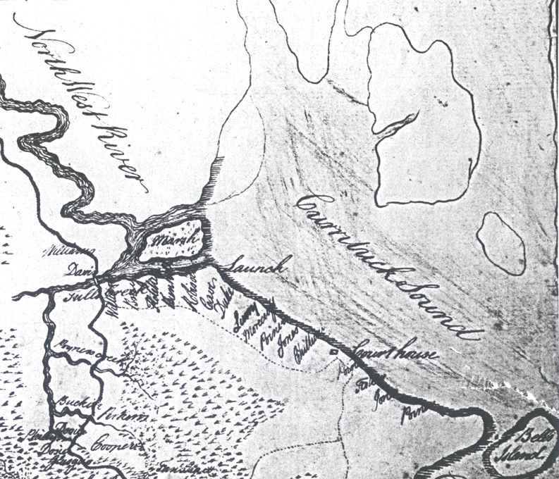
post-1770 Map of Currituck County (and others)
Image #1
![]()
| Image #2 (124 kb) - parts of Currituck and Camden counties |
| Image #3 (142 kb) - mostly Camden Co. |
| Image #4 (142 kb) - Currituck & Camden Co. |
| Image #5 (143 kb) - parts of Camden and Pasquotank counties |
| Image #6 (181 kb) - Pasquotank Co. |
Some geographical and place names listed on this page are: Northwest River, Currituck Sound, Bells Island, Marsh, Launch, Poyners Creek, Tulls Creek, and Court house.
Some surnames listed on this page (some more than once) are: Bray, Buckin*, Bunnill, Cave, Cooper, Chittum, Davis, Dosier, Duke, Fanshaw, Glasgow, Jones, Ketchum?/Kitchen?, Lurry, Morecrass?, Perkins, Phillips, Poiner, Robison, Talor?, and Williams. [*On modern day maps there is a Buckskin Creek in this vicinity. I'm not sure whether "Buckin" was intended for Buckskin or not.]
![]()
|
|
|
© 2005
Kay Midgett Sheppard