![]()
Mercator-Hondius Map - 1606
![]()
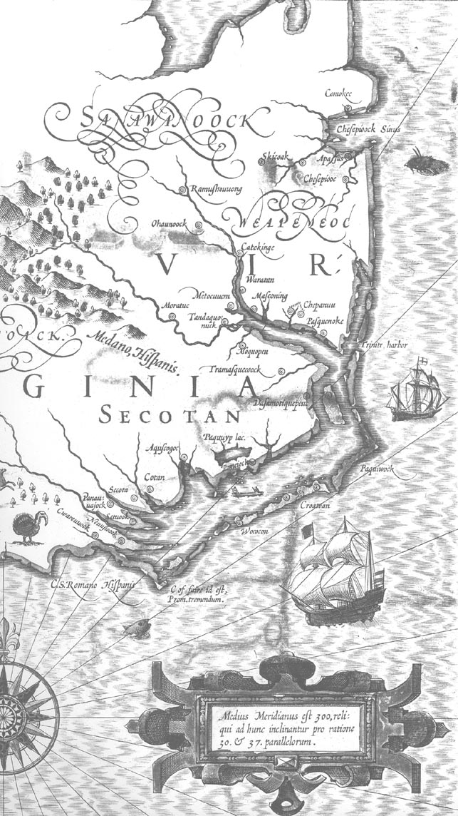
"A new Description of the American Provinces of Virginia and also of Florida" is one of the most beautifully designed and executed maps of the Southeast. The author of the map, Jodocus Hondius, derived the northern part of the map from the discoveries made by the English colonists along the Outer Banks of the North Carolina coast around 1785 and relied chiefly on White-De Bry 1590 for his interpretation of that region. He followed White in making Chesapeake Bay only a small indentation on the coast, in many of the physical details of the Outer Banks area, in its rivers, and in the names of the Indian villages. He made a number of changes in delineation, however, which distort the coastline. He increased the distance from Chesapeake Bay to Albemarle Sound, bringing Cape Lookout below the actual latitude of Port Royal, and also incorrectly identified or confused Cape Lookout (Promontorium tremendum) with Cape Fear (C. of faire). He then over compensated for this by extending the coastline west by north instead of southwest, thus placing Port Royal half a degree north of it actual latitude. Hondius' "Virginia and Florida" first appeared in the augmented atlas which he published after taking over the publishing firm of Gerhard Mercator, the sixteenth-century geographer and inventor of the Mercator projection, who died in 1594. For this map Hondius borrowed some details from the large world map of 1605 designed and published by his rival, Willem Janszoon Blaeu, although he drew most of his information directly from the two volumes of De Bry's Grand Voyages.
![]()
|
|
|
© 2008 Kay M. Sheppard