
Return to Currituck Co.
![]()
[Deed Book 28; pg. 25] Sabrina HACKETT of Currituck County sold to Solomon A. BAUM of Currituck County, for $100.00, "all my right being 1/2 of 1/8 in a tract of land known as the race ground tract in Currituck County which was devised by the last will & testament of Wm. S. ETHERIDGE to said Sabrina and others, the whole tract estimated to contain between 500 & 600 acres." This indenture made August 31, 1857. Wit: Willis TILLETT. /s/ Sabrina [x] HACKETT.
[Deed Book 28; pg. 57] J.B. LEE, Sheriff of Currituck County, was ordered by the Court to sell the lands of Hezekiah NORMAN, whereas Tilghman F. MIDGETT was the highest bidder at $47.42 to a tract of land in Currituck County joining Isaac OWENS and said Tilghman MIDGETT, containing 18 1/2 acres. This sale was made May 3, 1858. Wit: W.G. GRANBERRY. /s/ J.B. LEE, Shff.
[Deed Book 28; pg. 87-88] Isaac C. MEEKINS of Currituck County sold to Robert P. MIDGETT of Tyrrell County, for $1500.00, a tract of land on Roanoke Island joining Croatan Sound at Sam'l. BAUM's land and running to Broad Creek, containing 726 acres. This indenture was made May 26, 1858. Wit: S.B. JARVIS, J.C. DOUGH. /s/ Isaac C. MEEKINS.
[Deed Book 28; pg. 91] State of North Carolina - Currituck County - May 19th 1858. Know all men by these presents that I S. H. CADWELL of the above named State & County for & in consideration of the sum of one Thousand Dollars to me in hand paid by Isaac DAVIS of the said County & State & the receipt of which sum of money is hereby acknowledged have this day bargained & sold alined & confirmed & by these presents do bargain sell & confirm to the said Isaac DAVIS his heirs & assignes one Negro Slave by the name of William aged about Twenty three years & I the S. H. CADWELL & my heirs Administrators & Executors do warrant & defend the same to said Isaac DAVIS his heirs & assigns forever against the lawful clames & demands of all persons whome soever. In witness whereof I have here unto set my hand & seal the day and date above written. /s/ S.H. CADWELL. Attest Samuel S. BARNETT; B. JARVES
Currituck County Court May Term 1858.
This Deed from S. H. CADWELL
to Isaac DAVIS is exhibited in open Court & the execution of the same
acknowledged in due form of Law ordered registered. Attest J. W.
BAXTER C.C.C. Registered the 11th of August 1858. /s/
E. SIMMONS C.C.C.
[Deed Book 28; pg. 91] State of North Carolina - Currituck County. Know all [the word "persons" is inserted here] men, by these presents that I Bethany O. DANIEL have bargained & sold & by these presents do bargain & sell unto Joseph A. DANIEL boath of us living in the State & County above mentioned my right & title to a tract of Land on the North Banks which I heired from my grand Father Burket GUARD which right & title I defend from the land claimes of any other person & from my self or my heirs executors & assignes forever unto the said Joseph A. DANIEL & to his heirs & assignes forever without any reserve for the consideration of the sum of Twelve Dollars & fifty cents to me in hand paid before the encealing of these presents where unto I have set my hand & affixed my seal the 25th day of September in the year our Lord 1857. /s/ Bethany O DANIEL. Attest S. H. CADWELL, Jurat
Currituck County Court May Term 1858
This Deed from Bethania O DANIEL to Joseph A. DANIEL is exhibited
in open Court & the execution of the same proved by the oath of S. H. CADWELL
a subscribing witness thereto in due form of Law ordered registered.
Attest J. W. BAXTER C.C.C. Registered the 11th of
August 1858 /s/ E. SIMMONS P. Reg.
[Deed Book 28; pg. 104-105] Thomas BURGESS and his wife Elizabeth of Currituck County sold to Samuel N. MIDGETT of Currituck County, for $60.00, a tract of land on Roanoak Island bounded on the SE by Adam ETHERIDGE, on the SW by the MURPHEY land, on the NW by the said Samuel N. MIDGETT, and on the E by Hugh GALARD, containing 5 acres. This indenture was made September 25, 1852. Wit: Solomon A. BAUM, James L. BARNARD. /s/ Thomas E. BURGESS, Mary E. BURGESS. Registered: August 24, 1858.
[Deed Book 28; pg. 105] Elizabeth BURGESS and others conveyed to Samuel N. MIDGETT "...my lifetime right of the house & plantation whereon I have lived since the death of my deceased husband, Dempsey BURGESS..." for the consideration of the sum of $10.00. This indenture was made September 25, 1857. Wit: Solomon A. BAUM, James L. BARNARD. /s/ T.N. SPRUELL, Elizabeth SPRUELL. Registered: August 24, 1858.
[Deed Book 28; pg. 105-106] Samuel N. MIDGETT of Currituck County sold to Martha MIDGETT of Currituck County, for $100.00, a tract of land on Roanoke Island joining Hugh GAYLARD and running to the HUMPHREY line, then to Easter MEEKINS' road, "...it being the land I bought of Elizabeth BURGESS", containing 15 acres. This indenture was made October 20, 1851. Wit: Abraham TWINE, Adam D. ETHERIDGE. /s/ Samuel N. MIDGETT.
[Deed Book 28; pg. 119] [blank] 1858 - Jasper TOLER sold to Solomon A. BAUM., for $30.00, a certain tract of land lying on Kitty Hawk beginning at a Oak stump on Kitty Hawk Bay running northwest course to the grave yard thence the same course to a creek thence along the creek to the bay thence running the bay to the first station containing 25 acres. Witnesses: H.W. COBB, J. DOWDY. Registered: Oct. 26, 1858.
[Deed Book 28; pg. 119-120] Aug 31, 1858 - Josiah H. TILLETT sold to John WESCOTT, for $400.00, a tract of land lying and situated on Roanoak Island it being the tract of land of Thos. R. TILLETT my Father which heired by him bounded on the East side of Roanoak Island or the shore side in Edward BRECKHOUSEs line running Westwardly course binding BRECKHOUSEs line to Daniel MEEKINS line thence running Southwardly course binding MEEKINS line to the line that Daniel MEEKINS purchased of Littleton WYNNE thence on Eastwardly course ???? said line to the shore side on the East side Roanoak Island thence a Northwardly course with the shore side to the first station containing 168 acres, more or less. /s/ Josiah H. TILLITT; Witness: Willis TILLETT. Registered: Oct. 26, 1858.
[Deed Book 28; pg. 120] June 11, 1858 - John P. FORBS of Pasquotank County, sold to Little J. ETHERIDGE, for $140.00, a certain parcel of land upon Roanoak Island beginning at a pine sapling on said J. P. FORBS road thence binding S.B. JARVIS line South Westly to Croatan Sound thence with the sound to the SAWYER line thence with the same a North Eastwarly to the WHITEHEAD line or corner and thence northwardly to the first station to contain 50 acres. Witnesses: S.B. JARVIS, J..W. BAXTER. Registered: Oct. 26, 1858.
[Deed Book 28; pg. 241] Whereas by virtue of the Court wherein Timothy MIDGETT, Zachariah B. MORSE, A. SIKES, C.T. SAWYER, A. GIBSON, Willoughby OLDS and Benjamin OWENS were plaintiffs and Hezekiah NORMAN was defendant. The Court levied an order to sell the land of Hezekiah NORMAN on May 31, 1858. Said tract of land being in Currituck County was sold to Timothy (Tilmon later in deed) MIDGETT for $1.93 per acre adjoining Tilmond MIDGETT, Willoughby OLDS, Isaac OWENS and Benjamin OWENS, containing 41 1/2 acres. This sale was made May 31, 1858. /s/ J.B. LEE, Shff. Registered: July 14, 1859.
[Deed Book 28; pg. 285] Easter MEEKINGS sold to Francis A. MEEKINGS, for $300.00, a Negro boy named Ben, aged 21 years, and a Negro woman named Matilda, aged 17. This sale was made August 27, 1859. Wit: W.P. HARRISON. /s/ Esther MEEKINGS
[Deed Book 28; pg. 298] Sept. 2, 1859 - This is to certify that we the undersigned have this day agreed to the land we bought of Henry BALENTINE situated on Currituck Beach at and near Whales Head which belong to Samuel B. JARVIS. I Edwd. C. LINDSEY do agree that A. BAUM shall have for his part of said lands and marshes the 60 acres which formerly belonged to the GRIGGS heirs the 30 acres of Jones Point which formerly belonged Samuel SALYER & also on the South side of the slue 15 acres adjoining the ARMSTEAD land. I A. BAUM do agree that E.C. LINDSEY shall have for his part of said land & marshes the 20 acres & buildings on the land and formerly belonging to ARMSTEADs on which side Samuel B. JARVES lived and also the 50 acres at or near Sprys cove formerly belonging to the FISHER heirs. /s/ E.C. LINDSEY, A. BAUM. Witness: David C. LINDSEY. Registered: Nov. 22, 1859
[Deed Book 28; pg. 298] Aug. 27, 1859 - Sally A. TILLETT sold to Isaac TILLETT, for $4.00, a certain piece of land lying on the North Banks bounded as follows beginning at a pine on the Northerly line of the above tract of land 2 acres of land in the East corner of the land. /s/ Sally TILLETT. Witness: William E. ETHERIDGE, John H. SAWYER. Registered: Nov. 24, 1859.
[Deed Book 28; pg. 299] John F. BURFOOT sold to Edward SIMMONS, for $7500.00,a certain parcel of land at Currituck Court House and bounded as follows: beginning at the Sound adjoining the lands of John C. HETFIELD & wife thence a Southwardly course binding the Sound opposite the main road at the Court House thence up the main road opposite a post at or near the bend in the road South binding Joseph S. DEYs line thence North & East binding DEYs Westerly line to said SIMMONS line thence Southerly and Westerly course to Caleb ETHERIDGE decd. line, thence Northerly by a line of marked trees adjoining said ETHERIDGE and others to a forked gum a corner thence an Eastwardly course adjoining the land of John C. HETFIELD and others to the first station containing 172 acres. /s/ John F. BURFOOT. Witness: E. MORTON, W.G. GRANBURY. Registered: Nov. 23, 1859.
[Deed Book 28; pg. 356] March 1, 1853 - Mary TILLETT & Durant TILLETT of the County of Camden sold to Isaac T. AYDELOTT of Currituck, for $600.00, a parcel of land situated in Powells Point known as Broad Neck bounded as follows beginning at a chinquapine stake at the Sound running a Northeastwardly course to a ditch sunning said ditch various courses to its head thence to a pine at the corner of the TILLETT field fence thence a Northeastwardly course to a marked cherry tree standing near the road thence to a marked oak North corner of Joseph ETHERIDGE lands thence down the Long Island line to a gum thence a Westwardly course to a pine standing at the North West corner of said TILLETT field fence thence a Westwardly course to the sound down said sound or shoar to the first station containing 300 acres. /s/ Mary H. TILLETT, D.H. TILLETT. Witness: I.N. TILLETT. Registered: May 17, 1860.
[Deed Book 28; pg. 357] [day & month blank] 1856 - Isaac N. TILLETT County of Camden sold to Isaac T. AYDELOTT of the County of Currituck, for $300.00, a parcel of land on Powells Point known as Broad Neck being the same I the said TILLETT in common with my Brother and Sister inherited from my Father and bounded as followeth beginning at a chinquapine stake at the Sound running a Northeastwardly course to a ditch running with the said ditch various courses to its head thence a Northeastwardly course to a pine at the corner of the said TILLETT field fence thence a Northeastwardly course to a marked cherry tree near the road thence to a marked oak at the North Corner of the tract of land formerly owned by Joseph ETHERIDGE thence down the Long Island line to a gum thence a Westwardly course to a pine standing at the North West corner of the TILLETT field fence thence a westwardly course to the Sound down said sound or shoar to the first station, containing 300 acres. /s/ I.N. TILLETT. Witness: B.M. BAXTER. Registered: May 18, 1860.
[Deed Book 28; pg. 358] Aug. 31, 1858 - J.B. LEE Shff of Currituck and L.M. BELL of Currituck. Witnesseth that whereas by virtue of a Justices judgment wherein William FORBES was plantiff and Mark DOUGLASS was defenant execution issued and was levied on the lands of said defendant hereinafter described and the proceedings to the Court of Pleas and Quarter Sessions whereupon the said Court at May Term 1858 issued an order of sale to satisfy the sum of $30.00 with interest from the 1st of Jany 1857 together with all costs which the said DOUGLASS is liable, one other in favor of Wm. FEREBEE the sum of $4.00 interest from the 9th of Nov. 1857, One other in favor of Dennis FLORA for $17.00 interest from Jan. 1st 1858, One in favour of Jos. S. DEY adm. $11.80 interest from July 14, 1856 with a credit of $5.00 17 Jan. 1857. Sheriff did by virtue of his office and the writs did proceed on the 31st day of August at the Courthouse door to sell the said land and tenements for cash whereupon L.M. BELL became the purchaser at the sum of $138.00. The said land bounded as follows: called the SIKES tract on the East by the lands of Jackson BALLANCE on the South by the lands of Dempsey WALKER on the West by the lands of Joseph and Isaac BAXTER containing 53 acres. /s/ J.B. LEE, Sheriff. Witness: Dem. BELL. Registered: May 21, 1860.
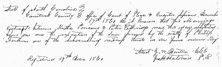
[Deed Book 28; pg. 422] Nov. 15, 1860 - I Rutha PARSONS of the County of Currituck and State of North Carolina of the first part and Peter ETHERIDGE second part after my just debts are paid do enter into a written agreement. I Rutha PARSONS do give unto Peter ETHERIDGE one half of all my property after my death and the other half after my death I give unto my children naming them Richard B. FISK , William R. SEARS, Caleb T. SEARS, Sara(?) June WILSON, Martin FISK children to them and their heirs forever, except five hundred dollars I leave it in the hands of the said Peter ETHERIDGE for him the said ETHERIDGE to pay the interest of the five hundred dollars to Bernice Ann PARSONS firmly(?) and every year during her natural life and if the said Bernice A. PARSONS dies without children or child I give unto Peter ETHERIDGE, his heirs forever but if the said B.A. PARSONS has children I give it unto them forever and Peter ETHERIDGE agree to relinquish all of my interest of the above property if I the said ETHERIDGE should die before the said Rutha PARSONS to her and her heirs forever. But if I said Rutha PARSONS should die before the said Peter ETHERIDGE one half of all my property as above written. /s/ Rutha PARSONS; Peter ETHERIDGE; Witnesses: Philip NORTHERN, Wm. H. BROTHERS
State of North Carolina
Currituck Count
Office of Court of Pleas
& Quarter Session December 17th 1860 -- Be it known that this Marriage
contract between Rutha PARSONS to Peter ETHERIDGE was this day exhibited before
me and the execution of the same proved by the oath of Phillip NORTHERN one of
the subscribing witness thereto in due firm ordered Reg. Registered 17th Dec.
1860. [MARRIAGE RECORD - see
image]
[Deed Book 28; pg. 422-423] Jan. 1, 1859 - Caleb T. SEARS sold to William R. SEARS, for $320.00, a certain piece or parcel or land it being a part of land known as the T. SEARS land bounded at corner between James M. FEREBEE & Samuel FULFORD & Wife, to a gum formerly in Willoughby BOSWOOD line, now and by the said W.R. SEARS, containing 16 acres. Registered: Dec. 10, 1860.
[Deed Book 28; pg. 423] Aug. 31, 1860 - Whereas Samuel TATUM is justly indebted to said Sally MILLER in the loan of $12.00 due, of bond bearing date the 2nd of March 1860, Samuel TATUM does bargain, & sell unto Sally MILLER a certain piece of land containing 15 acres adjoining the lands of L.M. BELL, Benj. TAYLOR & Augustus PARKER. To have and to hold said piece of land forever during the natural life of the said Samuel TATUM. Loan is to be paid by ???? 1861. Witness: Wm. L. GRANBERY.
[Deed Book 28; pg. 427-428] William D. AUSTIN and his wife Annie of Currituck County, "sell our claim in a certain tract of land containing 50 acres to Norris BAUM of Currituck County for the sum of $12.50", said land being on the North Banks and a trust that Burket GUARD gave to his daughter Annie, the wife of Wm. D. AUSTIN, which became her 1/4 dower. This indenture was made August 4, 1860. /s/ Wm. D. AUSTIN, Annie M. [x] AUSTIN.
[Deed Book 28; pg. 428] Daniel HAMAN and his wife Mary sold to Norris BAUM for $???. a parcel of marsh lying on ___lk Bay on Little Collington, containing 100 acres. This indenture was made December 22, 1859. Wit: W.E. ETHERIDGE. /s/ D. HAIMAN, Mary [x] HAIMAN.
[Deed Book 28; pg. 429-430] At 1857 Spring term of the Court of Equity, upon petition of the heirs at law of Zachariah OWENS dec’d., the Clerk and Master of said Court was to expose to public sale lands hereinafter described in a credit of 6 or 12 months in presence of said Master of Court on 21st day of August 1857. When and where upon Joshua HARRISON became purchaser of a certain tract known as the Collington tract for sum of $28.00, tract containing about 25 acres. In Spring term 1860 it was granted and decreed that the purchasers pay the money into Court and Clerk make title to them. Therefore this indenture in obedience to the order of said Court the purchasers money having been paid by Isaac T. AYDLETT, Hiram GALLOP & B.T. HARRISON administrators of said Joshua HARRISON, I Jas. B. MORGAN Clerk & Master of Equity grant & sell unto said Isaac T. AYDELETT, Hiram GALLOP & B.T. HARRISON the tract know as the Collington tract. I affix my seal this 27th day of November 1860. Registered 24th December 1860.
[Deed Book 28; pg. 430] Know all men by these present that I Nathaniel N. HAMPTON for and in consideration of the sum of $90.00 paid to me by Wm. J. WALKER for a certain lot of land situated on Churches Island commencing at A.J. WALKERs on the sound various courses binding A.J. WALKERs to Jonathans Creek various courses to first station containing Four and a half acres. This 23rd March 1860. Witness: E. H. WALKER. Registered 28th of December 1860
[Deed Book 28; pg. 430-431] November 3, 1860 - I Madison EVANS for and in consideration of the sum of $150.00 paid to me by Hiram G. GALLOP for a certain tract of land situated on Powells Point containing 13 acres. Beginning at Hodges GALLOPs line various courses to Thomas B. TILLITT line various courses to the lands of A.G. HARRISON Dec’d. thence various courses to first station of the corner of Hodges GALLOP fence. Witness: H.G. OWENS, T.B. HARRISON. Registered December 24, 1860
[Deed Book 28; pg. 431-432] November 29, 1860 - I Mitchel S. FEREBEE for and in consideration of the sum of $4250.00 paid to me by Wm. G. ROBINSON for a certain tract of land in Indian Ridge running various courses to old patent line various courses to first station to contain 301.3 acres. Witness: J.W. HINTON. Registered December 24, 1860
[Deed Book 28; pg. 432] November 12, 1860 - Jno. BARNARD doth hereby devise unto Jno. PERKINS two certain farms lying in the neighborhood called “Guinea” the one known as the John GRAY farm and the other as the GALLOP farm to hold for the term of 5 years from January 1, 1861 yielding and paying yearly on or before the first day of every January during said term the yearly rent of one third part of all the corn grown on said farms, and in case said PERKINS should cultivate and grow any other grains upon said farms then he is to pay such annual rent as they may hereafter agree upon. And Jno. PERKINS covenent to pay the said rent in manner afsd. And to deliver up the premises of the said BARNARDs or his Attorney peaceably and quietly at the and of the said term in as good condition as the same or may be put into by said BARNARD reasonable use and wear and tear thereof and other casualty excepted. And the leese further covenents that he will not do or suffer any nuter in the demised premises. Witness: Jas. M. HINTON. Registered December 24, 1860
[Deed Book 28; pg. 460] December 20, 1855 - Know all men by these present that I Benjamin T. SIMMONS to the Last Will & Testament of Sally SIMMONS deceased after having duly advertised at Court House & two other public places in County on the 20 day of December 1855, upon the premises by way of public venue offer for sale on the following terms to wit: 6, 12, & 18 months credit with lawful interest from date all her the said Sally SIMMONS right title interest & land to a certain tract of land in District of Cowinjock as the old homestead farm together with all the swamp and Marsh land to her belonging containing 500 acres. Whereas Dr. Eugene MORTON appeared & bid the sum of $2350.00 which being the highest and best bid it was stricken off. Witness: J.B. DEY, P. H. SIMMONS; Registered: March 16, 1861
[Deed Book 28; pg. 460-461] June 1, 1856 - Dr. Eugene MORTON for and in consideration of the sum of $2350.00 paid to me by Benjamin T. SIMMONS for a certain tract of land containing 500 acres more or less consisting of the homestead tract of the late Sally SIMMONS dec. and all the marsh & swamp thereunto attached, together with all Swamp & Marsh lands that belonged to the said Sally SIMMONS situated in Cowinjock District. Witness: J.B. LEE; Registered: March 16, 1861
[Deed Book 28; pg. 486] May 20, 1861 - For and in consideration of the sum of $2850.00 paid to me Benjamin T. SIMMONS by Samuel McHORNEY both of Currituck County for a tract of land containing 200 acres more or less, beginning on the Coinjock Bay at the center of the Landing Road various courses to John SIMMONS line thence with his line to the line known as the Sanderlin Swamp line thence a Southerly course to Jonathan TAYLOR dec., line binding said deceased line to the main road with the road to Levi WALKER Easterly to Coinjock Bay thence with the bay to the first station. Witness: P.H. SIMMONS, S.H. COWELL; Registered: May 24, 1861
[Deed Book 28; pg. 487] May 18, 1861 - For and in consideration of the sum of $1365.00 paid to James HALL by Benj. N. BRAY for a parcel of land known as the Launch containing One acre. Bounded on the South & West by the lands of Eliz? BRAY on the North by Launch Creek & on the East by the lands of B.N. BRAY being the lands devised by said B.N. BRAY as Trustee of Jno. GRAY by deed bearing date Oct. 18, 1856, reference to which will more fully show the boundaries. Witness: J.B. LEE; Registered: May 24, 1861
[Deed Book 28; pg. 513-514] Druplin GREGGS of Currituck County sold to Edward B. MIDGET of Currituck County, for $600.00, a tract of land in Currituck County on Churches Island and bound on the N by Willoughby BALLANCE, on the W by John JARVIS, SR., on the S by Edward B. MIDGET, and on the E by Currituck Sound, containing 36 acres. This indenture was made December 29, 1861. Wit: J. JARVIS, E.D. POYNER. /s/ Druplin [x] GREGGS
![]()
No part of these deed abstracts may be used for any commercial purposes. However, please feel free to copy any of this material for your own personal use and family research. If you find anything in these deeds that pertains to your families, I would strongly suggest that you either order a copy of the deed from the county or look at a copy of the microfilm on your own to check for errors or possibly other additional and helpful information.
|
|
|
|
|
|
|
|
© 2012

