
Return to Currituck Co.
![]()
[Deed Book 24; pg. 12] I Jacob AYDELOTT for and in consideration of the sum of $515.00 paid to me by Isaac TILLETT for four negro girls viz. girl Linner, Martha, Jane and Rachel. The said negroes Linner, the Mother, and Martha, Jane & Rachel. December 15th 1842. Witness Edward TILLETT
[Deed Book 24; pg. 26] This indenture made the 1st day September 1842, between Dempsey LEE of the one part and William ETHERIDGE SENR. Of the other part both of Currituck County and State of N. Carolina. I the said Demsey LEE for and in consideration of Four Hundred and Eighty Seven dollars and Fourteen cents the receipt whereof I do hereby acknowledge and have bargained and sold unto the said William ETHERIDGE SENR. a certain piece or parcel of land situated in Currituck County and bounded the land of William BRIGHT, Thomas SANDERSON and others formerly owned by Thomas LEE SENR. containing by estimation fifty acres. Witnesses: Israel FANSHAW, Jno. FANSHAW. Registered: March 15, 1843.
[Deed Book 24; pg. 27] August 8th 1842. This indenture between James M. FEREBEE and Samuel FEREBEE JR. both of the County of Currituck and State of North Carolina. For the sum of One Hundred Dollars sold to Samuel FEREBEE JR. a certain piece or tract of land which I purchased of Sarah HUTCHINGS beginning at the northwest corner of the land purchased by said Samuel FEREBEE from Dempse HUTCHINGS and running southeast course along said line between the said James and said Samuel, parcel to contain 4 acres more or less. Witness: D.D. FEREBEE. Registered: March 15, 1843.
[Deed Book 24; pg. 27-28] This Indenture made this Twenty Sixth day of September in the year One Thousand Eight Hundred and Forty Two between Malachi W. BEASLEY of the County of Currituck and State of North Carolina and W. BEASLEY of the same County & State. For the sum of Two Hundred and Thirty Five Dollars to him in hand paid by the afsd. Caleb W. BEASLEY for a certain piece or parcel of land situated and lying on Knotts Island , bounded beginning at Public road at a pine to the corner line between John WILLIAMS and Edmund BEASLEY’s land, south then west to Leven BALLANCE’s land, west along BALLANCEs line, then north to first station to contain Ten Acres more or less. Witnesses: Alexr.(?) SMITH, Dennis CAPPS. Registered: March 15, 1843.
[Deed Book 24; pg. 28] This indenture of agreement made this 25th day of February 1843 between Grace BAXTER of the one part and James M. LAND of the other part. For and in consideration of One Hundred Dollars paid to her by LAND…..my right of dower in the land where I now reside, it being the lands set apart to my Daughter Ann BAXTER in the division of her Father Thomas BAXTER estate. Witness: Joseph I. BAXTER. Registered: March 15, 1843.
[Deed Book 24; pg. 31] March 20, 1842. I, Eliza GARRETT, for and in consideration of the sum of Three dollars and Fifty Cents to me in hand paid by Hodges GALLOP…..Parcel of land I heired by the death of my Father John GARRETT. Adjoining the lands of the heirs of Samuel DOWDY dec’d, John GREVES and others. Witnesses: C.T. SAWYER, Thomas B. TILLITT. Registered: March 15, 1843.
[Deed Book 24; pg. 31-32] This Indenture made this 3rd of January One Thousand Eight Hundred and Forty Three between William LEIGH of the County of Norfolk in the State of Virginia of the one part and Spencer SPRY of the County of Currituck and State of North Carolina of the other part. For and in consideration of the sum of One Hundred Dollars to me in hand paid by Spencer SPRY…….parcel of land situate in Currituck County containing by estimation Sixteen acres more or less…..bounded oak stump at the main road at James SPRYs line….westerdly with SPRY’s line to William BALLs line…Northwardly course will BALLs line to James GIBSONs line…westward course with GIBSONs line to main road….southwardly course with main road to first station. Witnesses: Samuel BALL, Stephen G. FORBES. Registered: March 15, 1843.
[Deed Book 24; pg. 32-33] This indenture made and done this the Twenty Second day of October One Thousand Eight Hundred and Forty Two . I the said Benjamin TATUM for the natural love and affection which I have and bear for my Grandson Joseph BRABBLE. After my death I give Joseph a certain parcel of land being a part whereon I know live bounded as follows…beginning at the Southwest corner of the MACKEY house west across my land to the back line thence southwardly various courses of my line to the first station containing Twenty Five acres more or less. Witnesses: B.T. SIMMONS, Jas. WILLIAMS. Registered March 15, 1843.
[Deed Book 24; pg. 33] This indenture made this 1st day of September One Thousand Eight Hundred and Fifty Two between Spencer WALKER and Wife Sally of the one part and Caleb WALKER of the other part all of the County of Currituck and State of North Carolina. For and in consideration of One Hundred Dollars to us in hand paid by the said Caleb WALKER….A piece or parcel of land bounded as follows…west by the lands of James DOUGLASS, on the east by the lands of Anthony DOUGLASS, south by the lands of Caleb WALKER SENR., dec’d. to contain forty acres more or less. Witnesses: Samuel ONEIL, Sally ONEIL. Registered: March 15, 1843
[Deed Book 24; pg. 88-89] State of North Carolina Currituck County, 7th day of December 1843. Between Moses LEE & William SNOWDEN of the first part & second part, Tully L. DOZIER of the third part who is chosen as trustee for the other parties. Whereas the said Moses LEE is indebted to William SNOWDEN in the sum of Two Hundred & Twenty Dollars with interest from the 6th of December 1843 payable on the first day of January 1846 and if not punctually paid in order to secure the payment of the same hath covenanted and agreed to execute this convenance. I Moses LEE for and in consideration of the sum of One Dollar with interest from the 6th day of December 1843 to me in hand paid by Tully L. DOZIER …..hath granted, bargained and sold to him the said Tully L. DOZIER one piece or parcel of land containing Fifty Acres more or less on which I reside, to hold upon trust. If Moses LEE shall fail to pay the said William SNOWDEN the sum that it shall and may be lawful for said Tully L. DOZIER trustee after first of January 1846 to come at the request of the said SNOWDEN, to sell said piece or parcel of land for cash after thirty days notice at the Court House door a fee simple title and out of the money arising from the same pay the said William SNOWDEN the said Two Hundred & Twenty dollars with interest and pay the balance to Moses LEE. In case the debt shall be paid by LEE so as to render this sale unnecessary that he will release and give up all title to the said land to the said Moses LEE. Witnesses: B.T. SIMMONS, J.O. LITCHFIELD. Registered: December 15, 1843.
[Deed Book 24; pg. 95] This Indenture made Sixth day of September 1843, between Daniel LEE County of Currituck of the first part, Joseph DECORMIS of the Borough of Norfolk, Virginia of the second part and John HUMPHRIES of the County (Blank) & State of North Carolina who has been chosen trustee by the other parties. Whereas Daniel LEE is indebted to Joseph DECOMRIS in the sum of One Thousand Dollars with interest from this date, payment to be made in 12 months from this date Agrees to bargain and convey a piece or parcel of land in the County of Currituck known by the name of the Guinea Mill tract, with the mill, machinery & fixtures thereto belonging. Daniel LEE shall pay to the said Joseph DECORMIS the said sum of One Thousand dollars with interest on or before the first day of September 1844 if paid present shall be void. If Daniel LEE should fail or neglect to pay to the said DECORMIS the said sum with interest thereon it shall and may be lawful and full power is hereby vested in the said John HUMPHRIES to sell and dispose of tract of land, mill, machinery fixtures, rights, privileges and appentures to the higher bidder at auction for ready money, after giving Ten Days Notice of time and place of sale after paying DECORMIS, Court cost & charges the balance if any shall be paid the Daniel LEE. Witnesses: N.R. NORRISS to the signature of Moses LEE. James H. DECORMIS to the signature of Daniel LEE & Joseph DECORMIS. Registered: December 15, 1843.
[Deed Book 24; pg. 96] This indenture made this 12th day of Sept. 1843 between Samuel E. SEARS of the one part & Caleb J. ETHERIDGE of the other part. For and in consideration of Forty Four Dollars paid to me by Caleb J. ETHERIDGE…….a certain parcel of land near the herring run, it being a part of the tract formerly belonged to Robert D. FROST…beginning at Caleb J. ETHERIDGE corner….Alfred VERKINS and Samuel E. SEARS it containing 5 1/2 acres more or less. No Witnesses given. Registered: December 15, 1843.
[Deed Book 24; pg. 97] This indenture made and entered into this 1st day of Sept. 1843 between James M. LAND and John DOXEY….for and in consideration of the sum of One Thousand Dollars paid me in hand or secured to be paid by said DOXEY…..certain piece of land situated in Tulls Creek District known by the name of the TATEM Tract and lately the property of Thos. BAXTER bounded by Wm. BRAY’s heirs in the east, south by Wm. DOXEY, west Wm. BRAY his heirs, north by Tulls Creek containing Eighty Five acres. Witnesses: B.T. SIMMONS, J.A. BAXTER. Registered: December 15, 1843
[Deed Book 24; pg. 103-104] Doxey LEE to Deed in Trust William H. BAXTER to the use of Edmund H. BAXTER. This indenture made and entered into the 2nd day of January 1841 between Doxey LEE of the first and Edmund H. BAXTER of the second part and William F. (sic). BAXTER of the third part. Doxey LEE being justly indebted in the amount of Forty Five Dollars to Edmund H. BAXTER a certain note bearing even date…..whereas LEE is desirous to secure the payment of said debt…this indenture that for and in consideration of the premises together with the further consideration of the sum of One Dollar to said Doxey LEE in hand paid by the said William F.(sic) BAXTER……LEE hath granted and sold unto Wm. F. BAXTER a certain tract of land bounded as follows: North by the lands of Doxey LEE, South and Southwest lands of John BELL, East the public road. If debt is not full paid with interest by 2nd day of January 1842. It shall be the duty of Edmund H. BAXTER to advertise for 20 days to sell the lands at public auction to the highest bidder for ready money…..out of monies arising from sale, return all the necessary expenses of this trust, pay off and discharge the said debt and interest or what remains of debt…the over plus if any he shall truly and faithfully return to the said Doxey LEE. From this date until the date of sale the said Docey LEE shall be allowed to live on said land and use apply the profits thereof to his own use and benefit. If he should pay off the debt plus any interest and necessary expenses then this indenture shall become void and no effect otherwise to remain in full force. Witness: Jas. WILLIAMS. Registered September 9th 1841.
[Deed Book 24; pg. 104] Grant to Benjamin T. SIMMONS. This plat represents One Thousand and Sixty acres of vacant marsh and shoal land situated in the County of Currituck lying in Currituck Sound between MACKEY Island and the North Banks neer Ship Bay known by the name of Raccoon Island bounded as follows: Northwest point of Little Raccoon Island, binding said island slew, southeast to the south end of said island…..then across a slew to the northeast point of Big Raccoon Island…..South to Ship Bay…then various courses to beginning. Surveyed by Benjamin T. SIMMONS agreeable to a copy of the enclosed entry No. 1004. Entered by him the 3rd day of January 1842 and surveyed the 26th of May 1842. Chairmen David DUNTON, Jerman B. LITCHFIELD
[Deed Book 24; pg. 105] Know ye that we for and in consideration of the sum of Ten Dollars for every Hundred acres hereby granted, paid unto our Treasury by Benjamin T. SIMMONS a tract of land containing One Hundred and Sixty acres being Marsh and Shoal land in Currituck Sound between Mackey Island and the North Banks neer Ship Bay, known by the name of Raccoon Island (bounded as the previous entry on page 104)…….Yielding and paying to us such sums of money yearly or otherwise as Our General Assembly from time to time may direct. Provided that Grantee causes this grant to be registered in the Registers Office in Currituck. Whereof we have cause then our letters to be made patent and our Great Seal to be hereunto affixed. Witness: John M. MOREHEAD our Governor at Raleigh, the 16the day of January in the 67 year of the Independence of the United States and in the year of our Lord 1843. Wm. HILL Secretary of State. Registered: February 15 day 1843.
[Deed Book 24; pg. 344] Oct. 6, 1846 - Francis A. JARVIS sold to Samuel MERCER, for $1500.00, a certain piece of land formerly belonging to C. Jane NORTHERN in Moyock District binding on the land of William C. WILSON, John BARNARD, Wiliam MERCER’s and Sabrina WILSON containing 300 acres more or less. Witnesses: Wm. C. MERCER, Samuel E. SEARS. Registered: Dec. 15, 1846.
[Deed Book 24; pg. 403] This indenture made this the 12 day of August 1845 between Jesse B. LEE and Israel FANSHAW both of Currituck County, for the sum of Five Hundred and Seventy Nine Dollars paid to Jesse B. LEE…..certain tract of land bounded as follows…..beginning at Jerome LEE’s corner down said LEE’s line to Jordan C. BUNNELs line, down BUNNELs line to Mary LEE line…down said M. LEE line to the sound then running down sound to the first station containing One Hundred and Fifty Acres more or less.. Witness: Joseph S. DEY. Registered 15 Day of December 1845.
[Deed Book 24; pg. 403-404] This indenture made this 22nd day of August 1845 between Israil FANSHAW and William GALLOP both of the County of Currituck, for and in consideration of the sum of Five Hundred and Seventy Nine Dollars paid by GALLOP ….a certain tract of land butted and bounded as follows…..beginning at Tulls Creek Sound at the corner of Jerome LEEs line thence running down said LEE line to Jordan C. BUNNEL line thence down said BUNNEL line to Mary LEE line down M. LEE line to the sound thence various courses to the first Station containing One Hundred and Fifty Acres more or less. Attest: Joseph S. DEY. Registered: the 15 Day of December 1845.
[Deed Book 24; pg. 404-405] This indenture made the tenth of October 1845, between Catharine MORSE and Gideon FULFORD, for the sum of Four Dollars paid to the said Catharine MORSE by Gideon FULFORD, for a certain tract of land she heired by Samuel BUNNEL dec'd. bounded as follows….on South by Jordan C. BUNNEL, west by Washington BRIGHT, on north by Jerome LEE on the east by said C. FULFORD containing two acres and three quarters more or less. Witnesses: David MORSE, Thomas BAXTER. Registered: 15 Day of December 1845.
[Deed Book 24; pg. 405] I Edward FARROW in consideration of the sum of Thirty Seven Dollars paid to on the day of June 1844, parcel of land on the North Banks ner Nags Head bounded as follows….near the turn of my hill below my landing running a North course along the upper edge of the hill in front of said BENBERYs house & Kitchen to another pine at right angles from said line an easterly course so as to contain One acre with priviledge of firewood lightwood and posts on the tract purchased of Hugh CAYTON & Wife of which the premises and a port. Sealed 30th day of Sept. 1844. Witnesses: Robert T. PAINE, Charles WILLIAMS. Registered: 25th May 1846.
[Deed Book 24; pg. 406] Know all men by these present that Samuel E. SEARS of Currituck County for & in consideration of the sum of Forty Five Dollars to me in hand paid by James M. FEREBEE…..sold my right and title & interest to a certain negro woman by the name of Susan age about Fifty years, I do warrant the soundness of said woman. December 6, 1844. Witness: William T. CATLES(?). Registered: 15 Day of March 1845.
[Deed Book 24; pg. 406] Benjamin T. SIMONS Bill of Sale Levi WALKER. Received of Levi WALKER the sum of Two Hundred and Fifty dollars in full pay of negro woman Ginny belonging to the estate of Alexandria SPEER dec'd. as a sale by me for a distribution among the Heirs of said Alexandria this the 7th day of January 1845. Attest: Samuel B. DOZIER. Registered 15th day of June 1845.
[Deed Book 24; pg. 406-407] This indenture made this the 4th day of August 1844, between Caleb T. SAWYER & Caleb T. CHAPLAIN and for and in consideration of the sum of Sixteen Dollars to me paid by said Caleb T. CHAPLAIN ……a certain piece or tract of land known by the name of Wills Island & lying to the west of Moss Island on or in Currituck Sound Beginning at the south mouth of Oyster Creek Island running various courses the above named Marsh & Shoal. Witnesses H.J.S. WILLIAMS, Duke M. COX. Registered: 15th day of June 1845.
[Deed Book 24; pg. 407] This indenture made the 30th day of December 1844 between Young OLDS & Willoughby OLDS of Currituck County. For and in consideration of the sum of Twenty Five Dollars paid by Willoughby OLDS for a certain piece or parcel of land being in Powells Point bounded as follows….southwest corner of the field adjoining the land of Nathan ONEEL….easterly course by a of line of marked trees along said ONEELs lands to the HARDY land…northward course and a westward course along HARDYs land to the land of Joseph OWENS….along Joseph OWENS and Samuel OWENS lands ….westward course to main road then southward course along main road to the first station containing Ten Acres more or less. Witnesses: Thomas GRIGGS, Polly OLDS . Registered: 15 day of June 1845.
[Deed Book 24; pg. 408] This indenture made this the 20th day of July 1842 between Rich. JARVIS SR. of Camden County & Richard JARVIS JR. of Currituck County. Witnesseth that the said Richard JARVIS SR. for and in consideration of the natural love and affection which I have and towards my Nephew Richard JARVIS JR……have given him all of my right title and interest and claim which I have to any part or parcel of marsh land on the North Banks called by the name of Lunn Green (?) which land was conveyed to my Father Thomas JARVIS by Lawrence LUN…..about Fifty Acres. Sol. ASHBEE, Lydia ASHBEE. Registered: 15th day of December 1842.
[Deed Book 24; pg. 408] James HUTCHINGS To Deed of Sale James M. FERIBEE. Know all men by these presents in consideration of Two Hundred Dollars to me in hand paid by James M. FEREBEE…bargain and sell unto him all of my right and interest in and to a certain negro man by the name of America aged about Fifty years, the right whereof it being one half of said negro(?) This 31st day of October 1844. Witness: Gideon C. MARCHANT. Registered 15 March 1845.
[Deed Book 24; pg. 413] This indenture made this the 1st day of January 1846. I Thomas AYDLETT for and in consideration of the sum of $375.00 paid to me by Isaac AYDLETT for one negro boy named Britton. Witness: Thomas GARRETT, Sol. ASHBEE. Registered July 15, 1846.
[Deed Book 24; pg. 413-414] This indenture made this 5th July 1844. I Jehue GREAVES and Margaret GREAVES his Wife for and in consideration of the sum of $15.00 to them paid by Josiah PERRY for a piece of land lying in Little Colinton Island being all of their part of Fanny OWENS part of her Father Jehue OWENS land containing 13 acres. Witness: L. POYNER, A.S. WHITE. To William A. JARVIS and John BUNNEL Esq. whereas Josiah PERRY hath proved a deed of conveyance executed by Jehue GREAVES and his Wife Margaret GREAVES. Margaret GREAVES being infirm and unable to attend court, we appoint you to examine Margaret GREAVES privately and apart from her Husband regarding her consent in executing said conveyance of her own free will and accord without fear or compulsion of her said Husband.
[Deed Book 24; pg. 445-446] Nancy ETHERIDGE of Currituck County sold to Thomas MIDGETT of Tyrrell County, for $500.00, "...all my right, title, & claims of the land that I heired from my mother together with the buildings attached to the land being on Raonoak Island..." joining John B. ETHERIDGE, Solomon A. BAUM, Wilson FORBES, Thomas WESKETT, and Nathan BEASLEY, containing 75 acres. This indenture was made November 23, 1845. Wit: John C. MIDGETT, Jacob F. WRIGHT, John B. ETHERIDGE. /s/ Nancy [x] ETHERIDGE. Registered: March 15, 1846.
[Deed Book 24; pg. 482-483] John M. MIDGETT of Stumpy Point in Tyrrell County, "...for the natural love & affection which I bear unto my son Edward B. MIDGETT of Currituck County as well as for many other good causes, me having to move, have given unto him a parcel of land lying on Bodies Island..." beginning at the Sound on the NW side of South Deep Creek and running to Solomon MANN's, containing 150 acres. This deed of gift was made May 21, 1846. Wit: Solomon A. BAUM, Lewis MANN. /s/ John M. MIDGETT. Registered: June 15, 1846.
[Deed Book 24; pg. 543] Nov. [blank], 1846 - Sampson ETHERIDGE sold to Thomas B. TILLETT, for $500.00, a piece of land formerly owned and heired by Sampson ETHERIDGE, dec’d., containing 50 Acres more or less. The land situated on the extreme end of Powells Point, beginning at Currituck Sound and running on North West to Zachariah OWENS line, from his line North East to Levi MURRELLs line from MURRELLs line to Currituck Sound thence along said Sound South East course to the extreme point of sand thence Westward to first station. Witnesses: Edward B. Midgett, Joseph M. Daniel. Registered: Dec. 15, 1846.
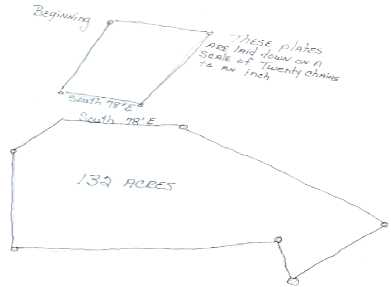
[Deed Book 24; pg. 577] Nov. 14, 1842 - Robert D. FROST sold to Samuel E. SEARS for $1500.00, a certain piece of land beginning at Chapel Bridge thence Northwesterly along the Creek to the forke thence Westwardly along Caleb ETHERIDGEs line then various courses to Alfred PERKINS thence South along Samuel ETHERIDGEs line to his plantation from plantation various courses to first station containing 133 acres more or less. Witnesses: A. PERKINS, Pharroah PERKINS. Registered: Mar. 15, 1847.
[Deed Book 24; pg. 580] Feb. 6, 1843 - Sally MURRELL Widow of Sampson MURRELL, Planter, sold to Josiah IVES, for $17.50, "my lifetime rights of the land whereon my Husband did live and die, lying on Powells Point beginning on the main road running Southerly & Southeasterly to the main road by various courses containing 7 Acres more or less. Witnesses: A.G. HARRISON, Zachariah OWENS. Registered: Mar. 15, 1847.
[Deed Book 24; pg. 622] This indenture made and entered into this the 1st day May 1847 between Alfred PERKINS and Lovey PERKINS his Wife and Willoughby McBRIDE…..for and in consideration of the sum of Fifteen Hundred Dollars do bargain and sell to the said Willoughby McBRIDE a certain tract of land……commencing at the Herring Run between Caleb ETHERIDGE and the said PERKINS land thence running up said run to Eldred ETHERIDGE land down said line to Tully L. DOZIERs land thence down DOZIERs line to Caleb BELLs land to Saml. ETHERIDGEs land thence down to said S. ETHERIDGEs line to Caleb ETHERIDGE line thence to the beginning at the Herring Run, the said tract of land containing One Hundred and Thirteen acres more or less. Witnesses: David MORSE, Jas. B. MORGAN. Lovey PERKINS privately examined and that she freely and of her own accord signed the deed. Registered June 15, 1847.
[Deed Book 24; pg. 623] This indenture made this the 11th day of January 1847 between Henry W. LEE and Branson C. BELL. I the said Henry W. LEE for and in consideration of the sum of Four Hundred Dollars to me in hand paid by the said Branson C. BELL do grant and sell a certain piece or parcel of land…in Indian Ridge district near Guinea butted and bounded as follows….beginning at the corner of Widow FLORA’s land Twenty feet from the canal on the main road, thence along Widow FLORA’s line westward course to the said Branson BELLs line thence from his line through the middle of the Cypress Run to the Beaver Dam, then down the Run to said Bullyard Canal, up the canal twenty feet from said canal to first station containing by estimation Fifty acres more or less. Witnesses: Benj. N. BRAY, William ETHERIDGE. Registered June 15, 1847.
![]()
No part of these deed abstracts may be used for any commercial purposes. However, please feel free to copy any of this material for your own personal use and family research. If you find anything in these deeds that pertains to your families, I would strongly suggest that you either order a copy of the deed from the county or look at a copy of the microfilm on your own to check for errors or possibly other additional and helpful information.
|
|
|
|
|
|
|
|
© 2010