For us with 'dial up' these are slow to load but, they are magnified
and you can read the names so clearly!
There will be some overlap of the areas so, you can verify names that
might be cut off, in one map.
Many thanks to Bill Vanlandingham for scanning the archives copy of
this and sending it for use by us!!
I don't think there will be a copyright problem, as it was from the
archives which is public domain.
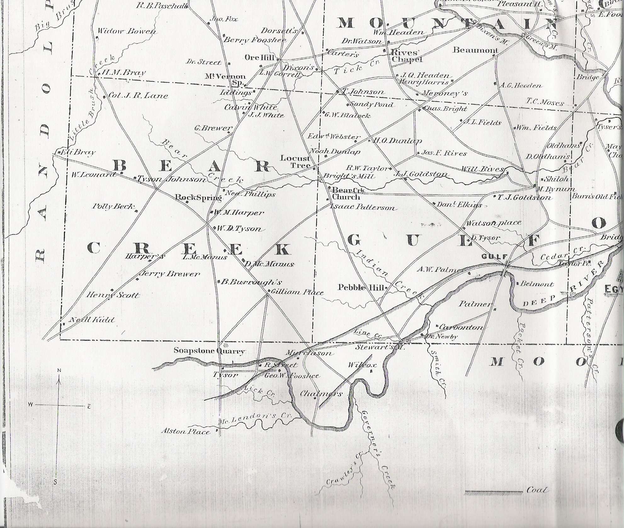
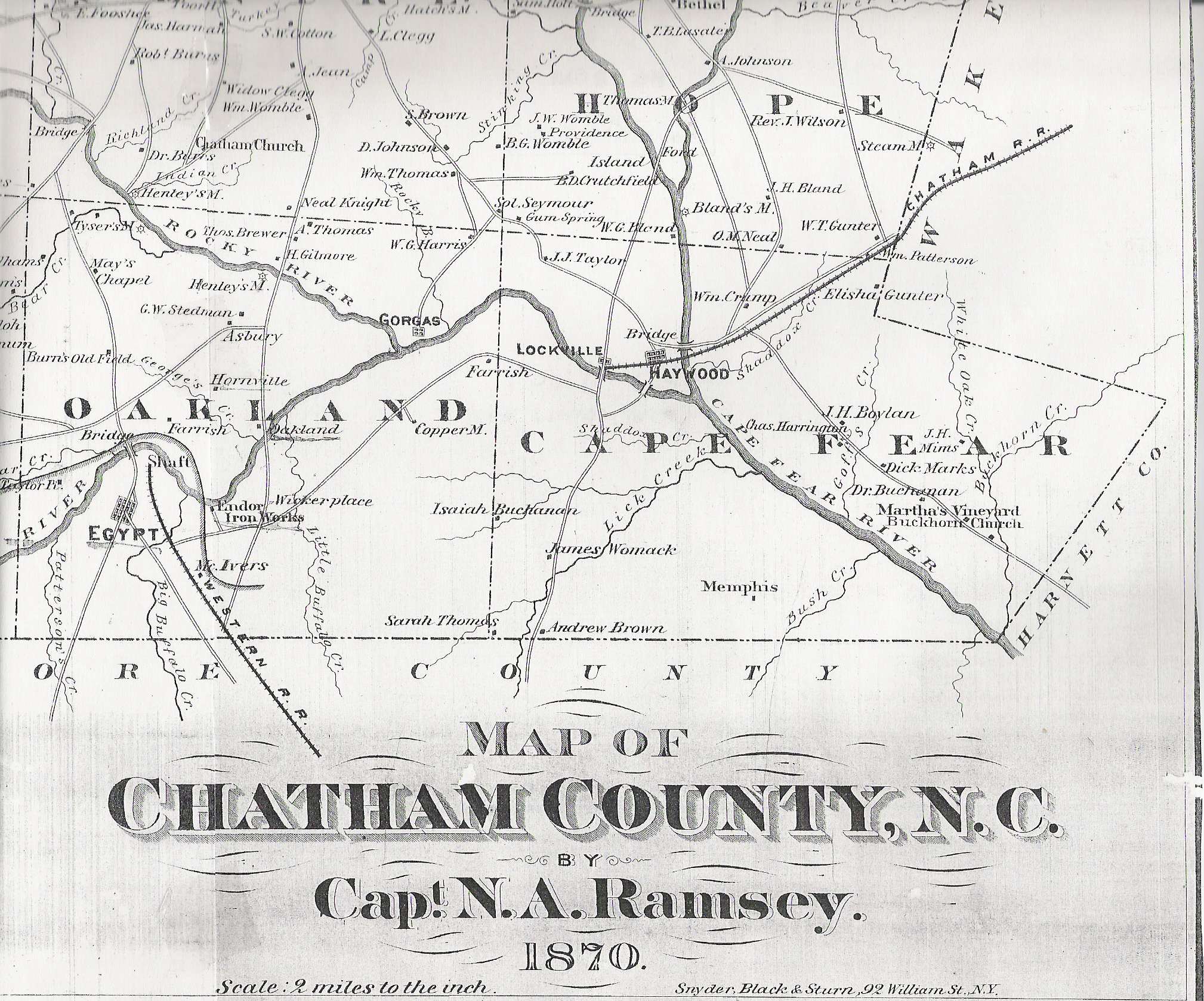
This is the way the county would have been in the census of 1870.
In four parts starting with:
1. NW corner - Albright,
part of Hadley and the Northern portions of Mathews & Hickory Mtn.
Townships
2. NE corner- Part
of Hadley, Baldwin, Williams and N. portions of Centre and New Hope Townships
3. SW corner- Bear
Creek, Gulf, part of Oakland and a S. portion of Mathews &
Hickory Mtn. Townships
4. SE corner- Cape
Fear, part of Oakland and S. portions of Centre and New Hope
P.S. Contact me if you need to know the first
names of people with only initials. I will see if I can identify them.
Sue